Story
Main experimental base (MEB)
The construction of the MEB SHI in the area of Terioki village (now Zelenogorsk city) began in accordance with the Resolution of the Council of Ministers of the USSR (June 16, 1946 No. 1647) in 1947. For construction, an independent construction and installation trust «Gidrometstroy» was organized in Leningrad, later transformed into the construction office of the GUGMS and the department of capital construction of the SHI. The technical project of the MEB SHI was developed by the Leningrad Branch of the Hydropower Project, with the involvement of the scientific departments of the SHI. The general scheme for the construction of the first phase was approved on May 21, 1948 by V.V. Shuleykin.
The development of the experimental base project and its implementation were conducted under the guidance of V.A. Uryvaev. A great contribution to the substantiation of the scientific tasks of the base was made by MA Velikanov, B.V. Proskuryakov, M.I. Lvovich, K.E. Ivanov, N.E. Kondratyev, G.I. Shamov and other scientists of the Institute. Initially, the management of survey and design work was carried out first by A.M. Senkov, and then S.S. Ginko. The first surveyors and builders of the base were A.N. Egorov, M.I. Akimov, M.I. Ostrovsky.
Director of the construction of the MEB SHI was appointed S.S. Ginko. The construction of industrial and residential buildings was carried out by capital structures (BF Sotnichenko, AA. Deev).
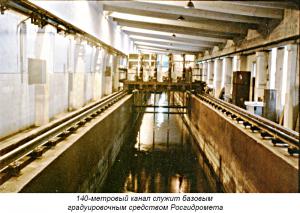
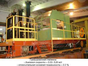
MEB SHI is located in the Illichevo village, 60 km from St. Petersburg. Its composition includes the following laboratories: hydrophysical, hydraulic (Ruslovaya), remote sensing methods and GIS (formerly laboratory of aero-methods), as well as straight-line 140-meter and circular calibration pools and installations for metrological research.
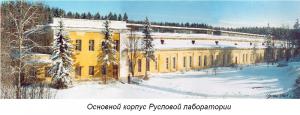
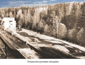
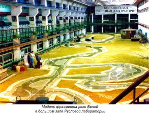
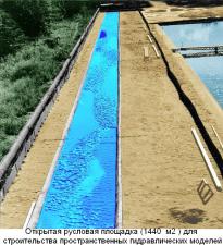
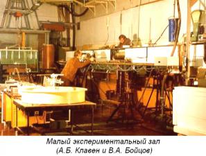
The channel laboratory is the main subdivision at the MEB SHI. It was created to study the patterns of development of channel processes, the development of methods for calculating and forecasting channel deformations in the design and construction of bridges, power lines, gas and oil pipelines, water intakes, pumping stations, etc. (A.B. Claven). A wide range of research in the Laboratory is conducted on hydraulic spatial models of river sections, in hydraulic glass trays.
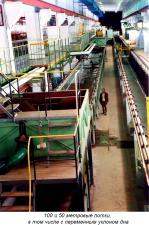
Large experimental hall for spatial modeling of water objects with an area of 1500 m2 with all the technological equipment necessary for building models and conducting experiments on them. The following installations are located in this room:
- 100 meter hydraulic tray 1 meter wide with a horizontal bottom and glass walls, equipped with an automatic driven measuring trolley;
- 50-meter hydraulic tray with a width of 2 meters with a horizontal bottom, glass walls and the ability to supply water and sediment on both sides of the tray;
- 25-meter hydraulic tray with a variable inclination of 0.8 meters in width with glass walls and bottom and the possibility of water supply from both ends of the tray.
The measuring equipment used in field and laboratory studies is represented by both standard instruments and original technologic equipment for hydraulic laboratories. Hydraulic trays with a length of 100, 50, and 25 meters and a width of 1.0, 2.0, and 0.8 meters, respectively, are installed in a large experimental hall for spatial modeling of water bodies, one of which is with a variable bottom inclination and the ability to supply water from both ends of the tray. In addition, the laboratory installed high-performance equipment for the separation of soils into fractions.
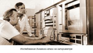
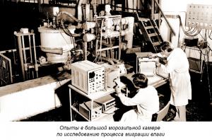
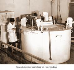
Hydrophysical Laboratory is located in the main building of the Channel Laboratory. Here under the leadership of V.V. Romanov and K.K. Pavlov began to conduct experimental work to study the migration of water in the soil, water infiltration into frozen and thawed soils. As a result of this experimental work, a little-studied phenomena were studied, such as the formation of a waterproof, so-called barrier layer in the soil in spring.
At present, these studies are being continued under the direction of I.L. Kalyuzhny and S.A. Lavrov. In addition to studying the infiltration of water into the soil, thermophysical studies are being conducted, the mechanism of the growth or destruction of ice cover, the formation of congestion and groundwater are being studied.
Employees of the Hydrophysical Laboratory I.L. Kalyuzhny, S.A. Lavrov, K.D. Romanyuk on the basis of generalization, analysis and mathematical modeling of heat and mass transfer processes, revealed the mechanism of the influence of climate change on the winter and spring river runoff and the hydrological regime of wetlands. It has been established that the main factors affecting the increase in winter runoff are a decrease in soil freezing depth, respectively, moisture migration in winter to the freezing front, its accumulation in a frozen layer, the presence of thaws and an increase in autumn soil moistening.
One of the main problems that the laboratory has been working on in recent years is the study of the water-absorbing capacity of river basins with the aim of improving methods for calculating the loss of melt water in the spring flood forecasts.
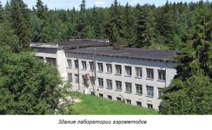
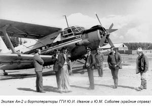
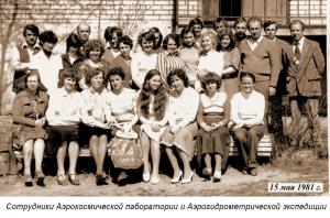
The Laboratory of Distance Methods and GIS (LDMGIS) is the assignee of the Laboratory of Aerial Methods. The Aerospace Laboratory (AKL) is located in a building specially built for this (on the initiative of V.A. Uryvaev). The first head of the laboratory was G.M. Lukashenko, and since 1975 - V.F. Usachev. As a result, the possibilities of using aircraft and satellite information for hydrological studies of snow cover, ice regime, the dynamics of flooding of floodplain lands, and for measuring flow rates in rivers and lakes have been clarified.
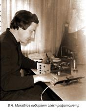
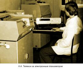
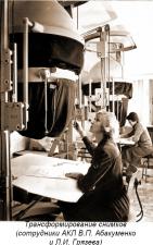
Developed and created: a spectrophotometer for assessing the pollution of snow, an electronic planimeter for determining the areas allocated on a map or a photograph (based on the Pallada phototelegraphic apparatus). A set of technical means for processing digital space information of images (V.A. Mikhailov, A.Z. Rakhmatullin, V. M. Korolev, A. A. Remenyuk, L. I. Gryazeva) was assembled and mastered.
Developed technologies for mapping hydrological characteristics of digital satellite information based on personal computers. In particular, floodplain mapping technology, a simulation model and an application package for constructing spill diagrams (for dates between satellite surveys), a method for assessing contaminated areas around cities were detailed.
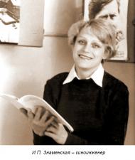
The success of many cases depended on the photolaboratory processing of aero films, projection printing of photographs, and re-shooting (I.P. Znamenskaya, Z.V. Sobolev).
The group of the department of metrology is part of the MEB SHI, which conducts a great deal of work on the certification of measuring instruments used in the practice of the network of hydrological stations and posts, as well as in scientific research (D.A. Konovalov, Y. B. Vakhrameev, A.Y. Simonenko).

